 24°C
24°C

Hidden Places In The Dominican Republic Few Tourists Reach
Beyond Punta Cana, Puerto Plata and the country’s best-known beaches, the Dominican Republic has remote landscapes where tourism remains comparatively limited: high mountain valleys, protected lagoons, indigenous rock art, dry forests and isolated coastal areas. Some require a long drive or a capable vehicle, while others are protected environments where access is regulated. These are some of the country’s lesser-known corners that can be explored without pretending they are completely undiscovered.


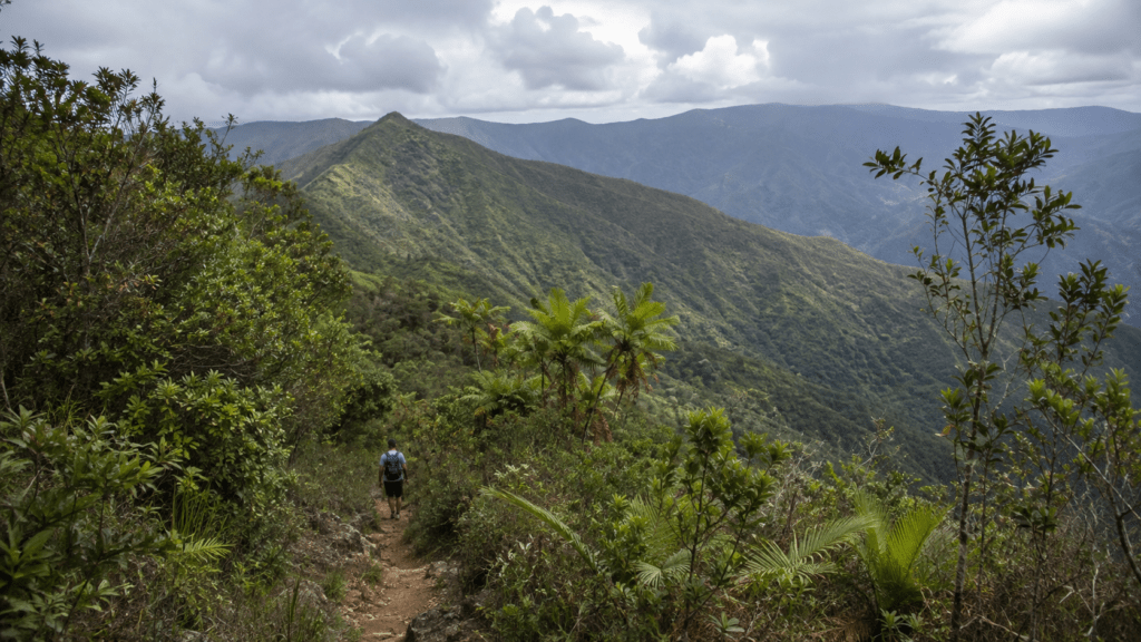
The Dominican Republic is usually presented through its most recognizable images: all-inclusive resorts in Punta Cana, the historic streets of Santo Domingo, the beaches of Puerto Plata and the palm-lined coast of La Romana. Yet the country has another geography that is much less visible to international visitors. More than a quarter of its land territory is included in protected areas, covering ecosystems ranging from dry coastal forests to cloud forests and high-elevation plains.
That geography creates a different kind of travel. In some places, the challenge is distance. In others, it is the absence of conventional tourist infrastructure. Several of the areas below are officially promoted for ecotourism, but they remain far removed from the concentrated resort tourism found elsewhere in the country. The point is therefore not that these places receive no visitors, but that they offer a markedly different experience from the Dominican Republic most travelers know.
1. Hoyo de Pelempito and the High Sierra de Bahoruco
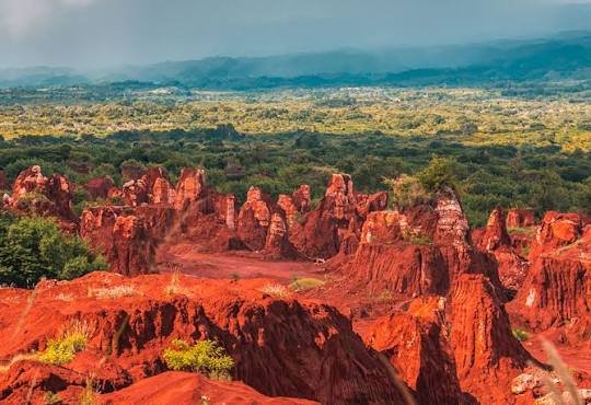
One of the strongest examples is Hoyo de Pelempito, a dramatic geological depression in the Sierra de Bahoruco in the southwest. Reaching the viewpoint involves a drive of almost 32 kilometers from near sea level toward the observatory in the Aceitillar area, at roughly 1,300 meters above sea level. Along the route, the vegetation changes dramatically, from dry landscapes to pine forest and eventually cloud forest.
The destination is part of the wider Sierra de Bahoruco, one of the country’s major protected mountain systems. The Ministry of Environment lists the Sierra de Bahoruco among the national parks that form part of the Jaragua-Bahoruco-Enriquillo Biosphere Reserve. The area is therefore important not simply because of its scenery but because of the ecosystems and endemic species protected there.
At Hoyo de Pelempito, the landscape changes again. The official tourism authority describes a geological depression approximately 700 meters deep, surrounded by the mountains of the Sierra de Bahoruco. Mountain trails near the observatory provide access to the highland environment, where temperatures can be dramatically lower than on the Caribbean coast.
This is not the kind of destination to approach as a spontaneous beach excursion. The distance, mountain roads and changing weather make preparation important. Visitors should also remember that they are entering a protected area, where environmental rules take precedence over convenience.
2. Las Caritas and the Landscape Around Lago Enriquillo
In the southwest, the landscape around Lago Enriquillo feels almost completely removed from the image of a tropical resort. The lake lies in the Hoya de Enriquillo, between the Sierra de Neiba and Sierra de Bahoruco, close to the Haitian border. It forms part of a nationally and internationally recognized protected landscape.
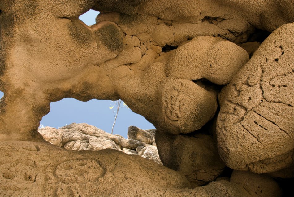
One of the less conventional stops is Las Caritas de Los Indios, a cave and rock shelter on the cliffs north of the lake. The site contains numerous indigenous petroglyphs. According to the Dominican Republic’s official tourism authority, the entrance is reached directly from the main highway by a staircase leading to the cave chambers and viewing platform.
The site is particularly valuable because it adds a historical dimension to a landscape that might otherwise be viewed only as a natural attraction. The petroglyphs are evidence of the Indigenous presence in the region long before the arrival of Europeans.
Lago Enriquillo itself is also unusual within the Caribbean. The Ministry of Environment identifies it as one of the core areas of the Jaragua-Bahoruco-Enriquillo Biosphere Reserve and notes its status as a Wetland of International Importance under the Ramsar Convention. Its combination of lake, mountains, dry ecosystems and protected wildlife makes this one of the most distinctive landscapes in the country.
For international visitors, the main attraction is precisely the contrast. This is a part of the Dominican Republic where the landscape can feel more like an arid basin than the humid Caribbean environment associated with the country’s beaches.
3. Laguna de Oviedo in the Jaragua Region
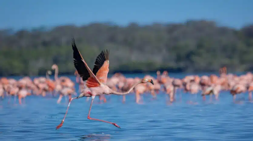
Farther south, within the Pedernales region, Laguna de Oviedo offers another side of the Dominican Republic. The lagoon is located within the protected landscape of the Jaragua area and is characterized by saltwater, mangroves and numerous small keys.
The official tourism authority describes Laguna de Oviedo as the country’s largest lagoon, extending for more than 10 kilometers and containing 24 keys. Its environment supports a wide range of birds, including herons, pelicans, roseate spoonbills and American flamingos.
Visitors normally experience the lagoon by boat. Excursions can last from one to three hours and are arranged through the Ministry of Environment information center near Oviedo. Early morning is recommended for wildlife observation because temperatures can become intense later in the day.
The experience is fundamentally different from visiting a conventional beach. The objective is not swimming or resort entertainment but observing a protected wetland and its wildlife. That distinction matters because the area’s ecological value depends on maintaining the conditions that support its bird populations and other species.
Pedernales itself remains one of the Dominican Republic’s least conventional tourism regions. The official tourism authority places it around five to six hours from Santo Domingo by road and emphasizes its protected parks, lightly developed beaches, dry landscapes and border culture. Its distance from the principal tourist corridors is one of the reasons the experience feels so different.
4. Valle Nuevo: The Cold Highlands of the Caribbean
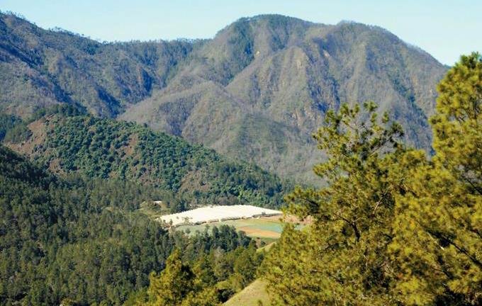
Few landscapes challenge the usual idea of what the Dominican Republic looks like more effectively than Valle Nuevo. Located in the Central Mountain Range near Constanza, the national park rises above 2,200 meters and contains pine forests, highland plains, cloud forests and mountain ecosystems.
The official tourism authority describes Valle Nuevo as an important source of rivers and identifies it as an area of exceptional biodiversity. More than 500 plant species have been recorded there, including numerous species endemic to the park. The high elevation also produces temperatures that can fall dramatically during the colder months, with frost and occasional ice reported in December.
One of the best-known landmarks inside the park is Las Pirámides, a pair of cone-shaped structures in an area known as La Nevera. They were built in 1958 by Spanish artisans as a symbol associated with completion of the road connecting San José de Ocoa and Constanza. A small museum and a Ministry of Environment campsite are located nearby.
The significance of Valle Nuevo is not simply visual. It represents one of the country’s most important high-elevation ecosystems and illustrates how dramatically the Dominican climate can change with altitude. A traveler can leave the warm lowlands and, within the same journey, arrive in a landscape of pine trees, mountain grasslands and cold morning temperatures.
Access requires more planning than a conventional resort excursion. The official tourism authority recommends a 4×4 vehicle or SUV for some routes toward Valle Nuevo and Aguas Blancas, and visitors should bring adequate clothing for cold conditions.
5. Río San Juan and Laguna Gri-Gri
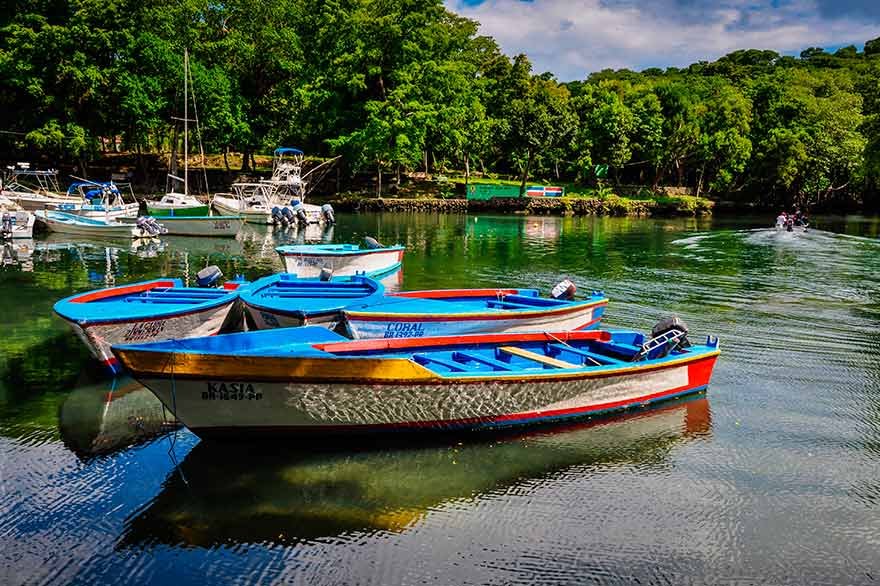
The northern coast also contains places that remain outside the country’s most heavily promoted resort circuits. Río San Juan, in María Trinidad Sánchez province, is a fishing town where the landscape is organized around mangroves, lagoons, beaches and the Atlantic coast.
Laguna Gri-Gri is one of its defining natural attractions. The protected lagoon is surrounded by mangroves and provides habitat for birds. Guided boat trips follow narrow channels toward the sea and can include a stop at Cueva de Las Golondrinas before continuing toward Playa Caletón.
The official tourism authority describes Laguna Gri-Gri as one of the country’s major bird sanctuaries. The setting is particularly different at sunset, when birds can be seen moving over the mangroves as the boats pass through the channels.
Río San Juan is also useful as an example of why the phrase “hidden Dominican Republic” should not automatically mean an inaccessible wilderness. Some lesser-known places are simply towns and landscapes that have developed a more modest tourism economy than Punta Cana or Puerto Plata.
María Trinidad Sánchez province is promoted for its beaches, cliffs, Atlantic scenery and seafood-centered local cuisine. The official tourism authority recommends the region for travelers looking for a quieter natural environment and lists Río San Juan and Laguna Gri-Gri among its principal attractions.
6. The Less-Traveled Side of Barahona
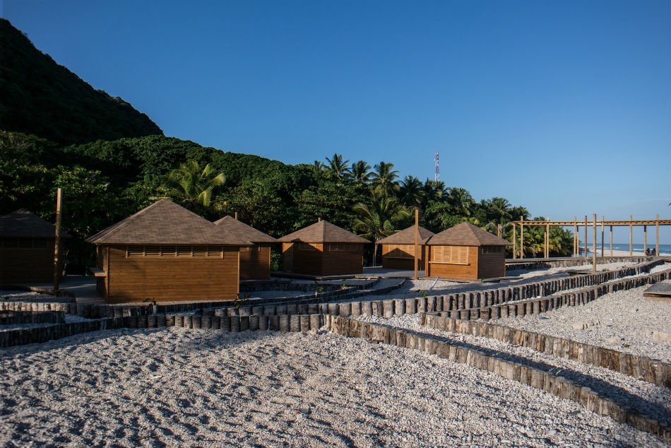
Barahona is no longer an unknown destination within the Dominican Republic, but much of the province remains outside the country’s traditional mass-tourism model. Its importance lies partly in the combination of coastline and mountains: stone beaches, cold rivers, dry landscapes and the Sierra de Bahoruco are concentrated within a relatively small part of the southwest.
The official tourism authority identifies places such as San Rafael, Los Patos, Playa Quemaito, Playa Saladilla and the Sierra de Bahoruco among the area’s attractions. It also promotes a coffee route through the Sierra, where visitors can encounter agricultural landscapes rather than the resort environment found elsewhere in the country.
San Rafael illustrates the region’s geography particularly well. A cold waterfall reaches a rocky coastal setting, creating an environment that is very different from a conventional white-sand Caribbean beach. Los Patos offers another river-and-sea landscape, while mountain roads provide views over the southern coastline.
Barahona also works as a gateway to some of the more remote areas of the southwest. From here, travelers can continue toward Lago Enriquillo, the Sierra de Bahoruco and Pedernales, turning a visit into a broader exploration of one of the country’s most geographically diverse regions.
The official tourism authority recommends exploring the area by car, particularly for travelers who want to combine coastal and mountain locations. That practical detail is important: the region’s appeal comes partly from the distances between individual attractions.
7. The Interior of Constanza and Its Agricultural Valleys
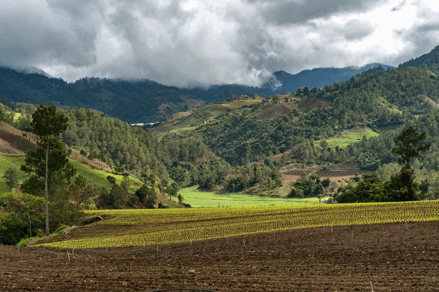
Constanza is better known than some of the places on this list, but its interior landscapes remain far removed from the Dominican Republic’s conventional beach tourism. The town sits high in the Central Mountain Range and is surrounded by agricultural valleys, pine forests and protected mountain areas.
The official tourism authority describes Constanza as a mountain and rural destination, with a climate considerably cooler than the country’s coastal regions. The area is known for agricultural production, including strawberries and vegetables, as well as for access to Valle Nuevo and the Ébano Verde Scientific Reserve.
Travelers who stay within the valley rather than simply passing through on the way to a national park can see a different aspect of Dominican life. Roads wind through cultivated fields and rural communities, while the surrounding mountains create a landscape that bears little resemblance to the flat coastal resort zones.
Mountain biking is also possible around Constanza, including routes through agricultural areas and toward communities such as La Sabina and Colonia Japonesa. The latter reflects one of the unusual chapters in the area’s modern history: Japanese immigrants settled in the region during the 1950s, contributing to the cultural character of the highland community.
The combination of agriculture, mountain climate and protected ecosystems makes Constanza particularly useful for travelers who want to understand the geographical diversity of the Dominican Republic rather than simply find another beach.
8. The Atlantic Coast of María Trinidad Sánchez Beyond the Main Beaches
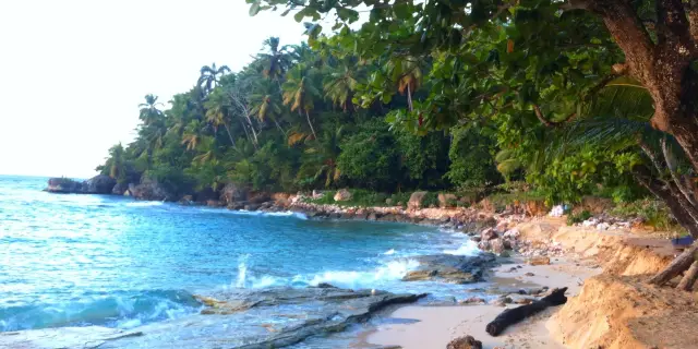
María Trinidad Sánchez province deserves a broader look because its appeal is not concentrated in a single famous attraction. Between Nagua and Río San Juan, the Atlantic coast combines beaches, cliffs, lagoons, fishing communities and stretches of landscape that have not been transformed into large resort complexes.
The official tourism authority highlights Playa Grande, Playa Caletón and Playa Diamante, along with Laguna Gri-Gri and the coastal scenery around Río San Juan. It also describes the province as a place where local life, seafood and natural surroundings remain central to the visitor experience.
This makes the region particularly interesting for travelers who are searching for places where tourism is present but does not dominate the landscape. The distinction is important: “hidden” does not necessarily mean empty. A coastal community can have restaurants, boat excursions and accommodation while still offering a very different rhythm from an all-inclusive resort corridor.
For visitors traveling by road, the province can also serve as a slower alternative to moving directly between major destinations. Spending time in Río San Juan and exploring the surrounding coast allows the journey itself to become part of the experience.
Why These Places Remain Outside the Main Tourist Routes
The reasons are relatively straightforward. The Dominican Republic’s international tourism infrastructure is concentrated around a limited number of destinations, while many protected landscapes are located far from those hubs. Some require several hours of road travel, mountain access or organized excursions. Others offer natural attractions rather than the accommodation, restaurants and entertainment infrastructure associated with resort tourism.
Distance is particularly important in the southwest. The official tourism authority places Pedernales roughly five to six hours from Santo Domingo by road, while Barahona is approximately three hours away. Such journeys make these regions less convenient for visitors whose trips are organized around a resort stay.

Environmental protection is another factor. The Dominican Republic’s Ministry of Environment reports that its National System of Protected Areas contains 131 conservation units and that protected terrestrial territory represents more than 25 percent of the country’s land area. These areas exist to conserve ecosystems, habitats and biodiversity, not simply to create tourist attractions.
That distinction explains why some of the most interesting places do not resemble conventional tourist destinations. Access can be limited, infrastructure can be modest, and responsible behavior is essential. In a protected landscape, the absence of development is part of the reason the place remains valuable.
How to Explore the Dominican Republic’s Less-Visited Areas Responsibly
Remote travel in the Dominican Republic requires a different approach from staying at a coastal resort. Visitors should research road conditions, weather and access requirements before leaving. In mountainous areas, temperatures can be dramatically lower than on the coast, while in dry southwestern areas heat can be intense.
Where a protected area is involved, visitors should use authorized access points and follow the instructions of the Ministry of Environment or local guides. Some attractions, such as Laguna de Oviedo, are specifically organized around guided excursions. That system helps visitors experience sensitive environments without treating them as unrestricted recreational spaces.
Travelers should also avoid assuming that every remote road is suitable for a standard rental car. The official tourism authority recommends capable vehicles for certain routes around Constanza and Valle Nuevo, while journeys into mountainous or isolated areas may require local knowledge.
Finally, the most useful rule is simple: do not confuse a quieter destination with a place where normal environmental standards no longer apply. Stay on established routes when required, take waste with you, avoid disturbing wildlife and respect local communities.
What to Expect From a Less-Touristy Dominican Republic
The biggest difference is not necessarily that the landscapes are more beautiful than those around the country’s famous resorts. It is that the relationship between visitor and place changes. In Punta Cana, tourism infrastructure is often the central feature of the landscape. In the Sierra de Bahoruco, Valle Nuevo or Laguna de Oviedo, the natural environment is the principal attraction and tourism remains secondary to conservation.
That also means fewer conveniences. A remote mountain viewpoint is unlikely to offer the same services as a resort beach. A protected lagoon may have scheduled boat excursions rather than unrestricted access. A long road journey may be necessary to connect two attractions.
For travelers prepared for those limitations, however, these areas reveal why the Dominican Republic cannot be reduced to its coastline. The country contains high mountains, cloud forests, dry forests, wetlands, caves, agricultural valleys and landscapes shaped by centuries of human history.
Frequently Asked Questions
Are these places completely undiscovered?
No. That would be misleading. All of the locations described here are known destinations or protected areas, and several are officially promoted by the Dominican Republic’s tourism authorities. The distinction is that they generally sit outside the country’s largest concentrations of conventional resort tourism or offer attractions that receive less international attention.
Which hidden place is best for mountain scenery?
Valle Nuevo and Hoyo de Pelempito are among the strongest choices. Valle Nuevo offers high-elevation pine forests, plains and mountain landscapes, while Hoyo de Pelempito provides a dramatic geological depression surrounded by the Sierra de Bahoruco.
Where can I see wildlife in a quieter environment?
Laguna de Oviedo is particularly suitable for birdwatching. Its mangroves and keys provide habitat for numerous bird species, including American flamingos, herons, pelicans and roseate spoonbills. Laguna Gri-Gri is another option, especially for observing birds around mangrove channels.
Which area is best for combining nature and local communities?
Barahona and Constanza are strong choices because their attractions extend beyond isolated natural sites. Barahona connects coastal landscapes with mountain agriculture and coffee production, while Constanza combines protected mountain areas with agricultural valleys and rural communities.
Do I need a 4×4 vehicle?
Not for every destination. However, the official tourism authority specifically recommends a 4×4 vehicle or SUV for access to some areas around Valle Nuevo and Aguas Blancas. Requirements can vary according to the route and conditions, so travelers should verify access before setting out.
Are protected areas open to independent visitors?
Access varies by location. Some sites have established visitor infrastructure, while others are better experienced through authorized guides or organized excursions. Laguna de Oviedo, for example, offers guided boat trips arranged through the Ministry of Environment information center.
What is the main difference between these places and Punta Cana?
The tourism model. Punta Cana is built around a highly developed international resort economy, while many of these locations are centered on protected ecosystems, rural landscapes, small communities or outdoor activities. Travelers should therefore expect fewer services and more emphasis on planning, nature and local context.
The Dominican Republic Beyond the Resort Map
The country’s lesser-visited corners are not hidden because they are secret. They are hidden in a more practical sense: they sit beyond the places that dominate international tourism marketing and require travelers to move farther, slower or higher into the country.
From the cold highlands of Valle Nuevo to the dry basin around Lago Enriquillo, from the caves of Las Caritas to the mangroves of Laguna Gri-Gri and the remote landscapes of Pedernales, these places demonstrate the extraordinary geographical range of the Dominican Republic.
They also show why responsible exploration matters. Many of the landscapes that feel most remote are protected precisely because they contain ecosystems, wildlife and cultural resources that are difficult to replace. The best way to discover this side of the country is therefore not to search for places untouched by everyone, but to travel beyond the established tourist corridors while respecting the environments and communities that make those places distinctive.