 23°C
23°C

Dominican Republic Coastal Sustainability: What the Study Found
A new study published in Ambio finds that the Dominican Republic’s coastal provinces are following sharply different development trajectories, with more than three-quarters classified within scenarios associated with high pressure on natural resources. The research does not mean that 75% of the provinces are simply “degraded.” Instead, it shows a more complicated picture: economic activity, agriculture, tourism, ecological value, cultural assets, social conditions and territorial planning do not move together, producing places where economic development comes with environmental pressure and others where strong conservation coexists with weak socioeconomic performance.


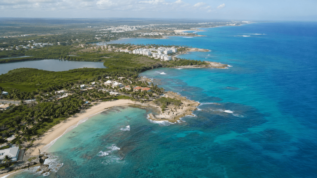
For a country whose economy, population and natural heritage are closely tied to the coast, sustainability cannot be measured by a single environmental indicator. That is the central premise of a 2026 study in Ambio that examines the Dominican Republic through a much broader lens, combining ecological conditions with economic activity, production, culture and social development.
The study, led by Natividad Pantaleón with Abel E. Camilo, Marina Rodes Blanco, Miguel A. Zavala and Antonio Gómez Sal, evaluates 17 coastal provinces and the National District using 148 indicators. Together, those territories accounted for 69% of the country’s population in the 2022 census data used by the researchers. The study’s purpose was not to produce a simple ranking of “good” and “bad” provinces, but to identify different territorial patterns and compare them with theoretical development scenarios.
That distinction matters. The headline finding is that more than 75% of the coastal provinces fall into scenarios associated with substantial pressure on natural resources. But the researchers did not define those provinces as uniformly environmentally destroyed, nor did they claim that a single factor caused the observed conditions. Their analysis instead points to different combinations of tourism, agriculture, livestock, urbanization, infrastructure, conservation, cultural resources, poverty and governance that produce different sustainability challenges.
Why the Dominican Republic’s Coast Matters
The research focuses on the part of the country where many of its most important economic and environmental systems meet. The 17 coastal provinces range from densely urbanized areas to rural territories and include places shaped by mass tourism, agriculture, fishing, mining, commerce and industry.
The study describes a coastal profile of about 1,668 kilometers and identifies a wide variety of coastal environments, including beaches, reefs, lagoons, mangroves, estuaries, dunes and rocky shorelines. The researchers also note that the country’s protected-area system covers a substantial share of national territory and includes marine protected areas.
For international readers, the significance is straightforward: the Dominican Republic’s coast is not a single economic or ecological zone. Punta Cana, Santo Domingo, Samaná, Pedernales, Montecristi and other coastal territories operate under very different combinations of population density, investment, natural resources and productive activity. A national policy that treats them as interchangeable can therefore miss important differences.
The population dimension is particularly important. The study uses data from the National Statistics Office (ONE), the Dominican Republic’s official statistical agency, and identifies the 17 coastal provinces as home to 69% of the national population according to the 2022 census. ONE’s census program provides population data at the provincial and municipal levels, making it possible to understand the demographic concentration behind the study’s territorial analysis.
What the Researchers Actually Measured
The researchers divided sustainability into five dimensions: ecological, productive, economic, cultural and social. Each dimension was evaluated separately before the results were integrated.
The ecological dimension considered characteristics such as biodiversity, ecosystems, life zones, protected areas and environmental pressures. The productive dimension focused heavily on agricultural and livestock systems, infrastructure supporting production, irrigation and related productive capacity. The economic dimension incorporated factors including tourism, investment, employment, formal businesses and mining.
The cultural dimension went beyond conventional measures of tourism or heritage. It included traditional knowledge, cultural practices, ancestral techniques, archaeological resources, education and women’s participation in local government. The social dimension incorporated population density, higher education, health services, infrastructure, access to drinking water and indicators associated with poverty, unemployment and other social conditions.
This structure is important because sustainability can look very different depending on which dimension is measured. A province can have substantial ecological value but relatively weak socioeconomic indicators. Another can have strong economic activity while facing significant environmental pressure. The study was designed to capture precisely those contrasts.
How 148 Indicators Became a Territorial Assessment
The methodology is more sophisticated than adding scores together. The researchers first selected variables representing the five dimensions and then standardized values between 0 and 100 so that indicators measured in different units could be compared.
They used Detrended Correspondence Analysis (DCA) to explore patterns within each sustainability dimension. In simple terms, DCA is a statistical technique that helps researchers identify relationships and gradients within complex sets of variables. It allowed the study to determine which characteristics contributed most strongly to the patterns observed in each dimension.
The researchers then used correlation analysis to examine relationships among indicators and to test whether the five dimensions were sufficiently distinct. The relatively low correlations among most dimensions supported the decision to treat them as separate components of the broader assessment rather than assuming that one dimension automatically represented another.
A second statistical step used hierarchical cluster analysis, based on Ward’s method, to group provinces with similar patterns of land use and productive activity. The resulting groups were called Development Coastal Areas, or DEPCAs. This helped identify territorial similarities before the researchers made their final sustainability classifications.
Finally, the researchers used Discriminant Analysis to compare the multidimensional results with predefined theoretical development scenarios. This step is what produced the study’s most recognizable finding: the classification of the 17 territories into different development pathways.
The Scenarios Are Not Simple Rankings
The study considered seven theoretical sustainability scenarios, but the Dominican coastal provinces occupied only five of them. The scenarios are analytical models designed to describe development trajectories; they are not predictions that a province will inevitably follow a particular path.
The five scenarios identified in the Dominican Republic were Diversified Unsustainable Traditional, Diversified Sustainable Traditional, Diversified Sustainable, Highly Urbanized and Highly Preserved. Two scenarios, Highly Degraded and Sound Sustainable, were not observed among the 17 coastal territories.
| Scenario | What the study found |
|---|---|
| Diversified Unsustainable Traditional | Traditional productive activities coexist with strong pressure on natural and cultural resources. |
| Diversified Sustainable Traditional | Traditional activities remain important while ecological and natural values receive comparatively stronger protection. |
| Diversified Sustainable | Diverse economic activity is combined with comparatively lower ecological impact and stronger ecosystem protection. |
| Highly Urbanized | Strong urban, commercial, industrial and service activity is associated with substantial pressure on ecosystems and coastal-marine systems. |
| Highly Preserved | High ecological and cultural value coincides with extensive protection, but socioeconomic and productive development remains limited. |
Because the scenarios are multidimensional, they should not be interpreted as a league table. A province classified as Highly Preserved is not necessarily “better” overall than a province classified as Diversified Sustainable. The classification describes a particular combination of ecological, economic, productive, cultural and social characteristics.
What the 75% Finding Really Means
The study’s most widely reported result is that more than 75% of the coastal provinces belong to scenarios associated with high resource pressure and degradation. The authors identify the Diversified Unsustainable Traditional and Sustainable Traditional scenarios as the principal groups behind this result.
With 17 provinces in the analysis, the percentage corresponds to more than three-quarters of the study area, but it should not be translated into a claim that “75% of Dominican provinces are degraded.” That would flatten a multidimensional classification into a single environmental label that the researchers did not use.
In the study, the pressure is connected to different combinations of coastal development, intensive agriculture and livestock, resource use and land-use change. In the Diversified Unsustainable Traditional scenario, for example, the researchers describe traditional agriculture and extensive livestock production as having significant impacts on water resources and pollution, alongside biodiversity loss and erosion of ancestral knowledge.
The finding therefore says more about development trajectories than about the physical condition of every hectare within a province. A province can contain healthy forests, protected areas or productive communities while still displaying a broader pattern in which resource use and development create substantial sustainability pressures.
The Provinces Do Not Face the Same Problem
One of the study’s most useful contributions is its emphasis on territorial differences. The results show that the coastal Dominican Republic does not have one sustainability problem. It has several.
Pedernales: High Ecological Value, Low Social and Economic Performance
Pedernales represents the study’s Highly Preserved scenario. More than 60% of its territory falls within protected areas, and the province includes ecologically important areas associated with the Jaragua-Bahoruco-Enriquillo UNESCO Biosphere Reserve.
Yet the same province records comparatively low economic, productive and social development indicators in the study. The researchers associate this combination with geographic isolation, limited infrastructure and insufficient investment in inclusive development.
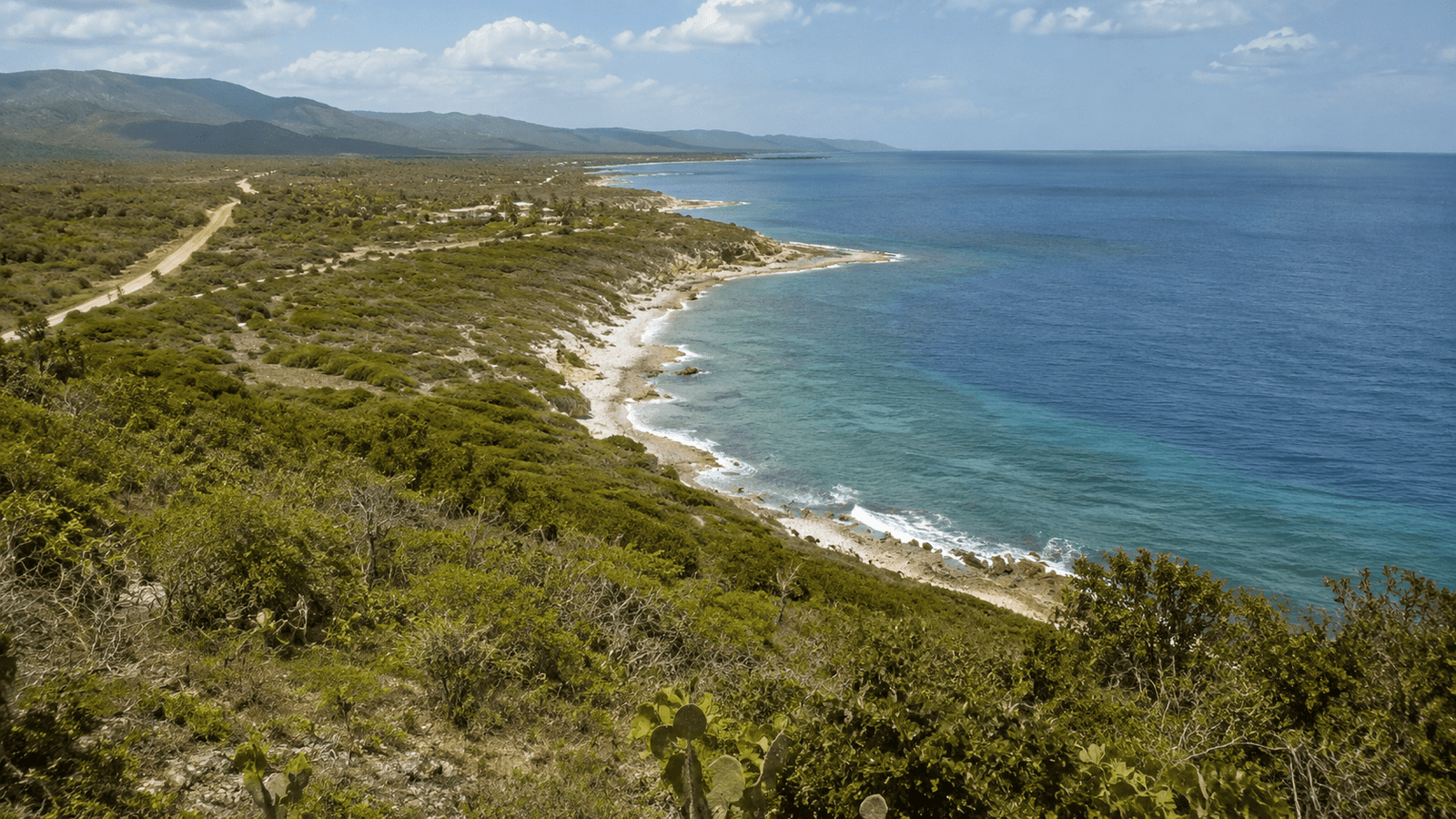
That creates an important policy lesson: conservation and development should not automatically be treated as opposites. The Pedernales case illustrates that protecting ecosystems does not by itself guarantee broad socioeconomic development. The challenge is to make conservation compatible with effective local economic and social opportunities.
The National District: The Opposite Territorial Pattern
The National District, which contains the country’s capital, occupies the Highly Urbanized scenario. Its social dimension scores at the top of the study’s analysis, reflecting its concentration of population, universities, health facilities and services.
At the same time, its ecological score is at the bottom of the study’s scale. The researchers describe highly urbanized spaces, limited natural areas and significant pressure on aquifers and coastal-marine habitats.
The contrast with Pedernales is striking because it demonstrates why a single sustainability score can be misleading. The capital’s strong social and economic infrastructure does not translate automatically into strong ecological performance.
Samaná and La Altagracia: Tourism as an Opportunity and a Pressure
Samaná and La Altagracia are among the provinces associated with the Diversified Sustainable scenario. The study identifies tourism as a major economic driver, including beach tourism, real estate and whale watching in Samaná and the tourism centers of Bávaro-Punta Cana and Bayahibe in La Altagracia.
The researchers do not present tourism as inherently sustainable. Rather, these provinces illustrate the possibility of combining economic activity with stronger ecological protection when development is managed through sustainability criteria. At the same time, the study warns that rapid or unplanned growth could weaken that balance.
The scale of tourism helps explain why this issue matters beyond environmental policy. Official investment data compiled by ProDominicana, drawing on Central Bank figures, show that the Dominican Republic had more than 90,000 hotel rooms in 2024, while total visitor arrivals reached about 11.2 million. Those figures provide economic context for the study’s observation that tourism is a major component of several coastal development trajectories.
The study does not establish that tourism caused environmental degradation in any particular province. Instead, it identifies an association between tourism-led development, territorial patterns and sustainability conditions. That distinction is essential when interpreting the results.
Agriculture Is Part of the Sustainability Equation
Agriculture and livestock feature prominently in the study because they remain important components of coastal territorial economies. The productive dimension includes irrigation infrastructure, controlled-environment agriculture, agricultural producers, subsistence farming and other measures of productive capacity.
Espaillat records the highest productive-dimension score in the study, followed by Azua, Peravia and San Cristóbal. The researchers associate higher scores with infrastructure and technologies that support agricultural modernization and efficiency, including irrigation canals, controlled production environments, paved roads and renewable energy use.
Other provinces display a different pattern. Samaná, San Pedro de Macorís and Puerto Plata have low productive-dimension scores in the study, reflecting lower levels of agricultural modernization and limited irrigation infrastructure. The researchers also emphasize that artisanal fishing and subsistence agriculture remain important to coastal communities.
These findings reinforce a broader point: sustainability is not simply a matter of reducing economic activity. The study’s productive dimension asks how production itself is organized, what infrastructure supports it and how resource use interacts with ecological and social conditions.
The Economic Dimension Rewards Activity — Not Necessarily Sustainability
The study’s economic dimension illustrates another potential source of confusion. Samaná, El Seibo and La Altagracia record the highest economic values, with tourism development, airport arrivals, private construction investment and other economic indicators playing a major role.
The National District also scores strongly because of private investment and employment in the service sector. Hato Mayor records a comparatively high position as well, influenced by economic activity, construction investment and mineral extraction.
But economic performance and sustainability are deliberately separated in the study. A strong economic score does not mean that a territory has achieved environmental or social sustainability. The statistical model was designed precisely to prevent those concepts from being treated as interchangeable.
This is one reason the study’s five-dimensional structure is more informative than a conventional economic ranking. It makes visible the possibility that economic gains and ecological conditions can move in different directions.
Culture and Social Conditions Change the Picture
The cultural dimension adds another layer that is often absent from environmental assessments. The researchers consider traditional knowledge, cultural manifestations, ancestral craft techniques, archaeological sites, education and women’s participation in local government.
Pedernales ranks highest in the cultural dimension, partly because of the presence of caves with archaeological and cultural importance. The study also identifies high or medium-high cultural values across most of the other provinces, while the National District and Santo Domingo show comparatively lower values in some measures of traditional cultural conservation.
The social dimension produces a different map. The National District scores highest, reflecting its concentration of higher education, universities, hospitals, physicians and public services. By contrast, Samaná, Pedernales, El Seibo and Montecristi record the lowest social-dimension values in the study, with factors including unemployment, migration and household poverty contributing to the results.
This contrast is particularly important for international readers because it demonstrates why environmental sustainability cannot be assessed independently of human development. A protected landscape may have extraordinary ecological value while the communities living around it face limited access to infrastructure, education, health care or economic opportunity.
What the Study Says About Territorial Planning
The authors’ central policy argument is that sector-by-sector planning is insufficient for complex coastal territories. Tourism agencies, agricultural authorities, environmental institutions, infrastructure planners and local governments may each focus on different objectives, but the landscape itself does not respect those administrative divisions.
A new road can change land-use patterns. Tourism investment can increase employment while increasing pressure on water and ecosystems. Agricultural modernization can raise productivity while changing resource demand. Protected areas can preserve biodiversity while leaving surrounding communities with limited economic options if inclusive development is not addressed.
The study’s multidimensional framework is designed to make those interactions visible. Its combination of statistical classification and scenario analysis allows planners to distinguish between territories that may require very different interventions.

For a province under a pressure-heavy traditional scenario, the priorities may involve improving agricultural practices, reducing resource degradation and strengthening socioeconomic opportunities. In a fast-growing tourism province, the challenge may instead be regulating expansion and protecting ecosystems before pressures become harder to reverse. In a highly preserved territory such as Pedernales, the priority may be improving the socioeconomic effectiveness of conservation rather than simply expanding protected areas.
Why the Study Matters Beyond Environmental Policy
The research is relevant not only to conservation specialists. Its findings touch tourism, agriculture, real estate, infrastructure, local development and public administration.
For tourism, the study suggests that the long-term value of destinations depends on more than visitor numbers and hotel capacity. Ecological assets such as beaches, reefs, mangroves and protected areas are part of the territorial foundation on which tourism depends.
For investors and developers, the findings underline the importance of territorial context. A project located in a rapidly urbanizing coastal province faces different sustainability constraints from one located in a highly preserved region. The study does not evaluate individual projects, but its framework demonstrates why provincial conditions matter.
For agricultural planning, the research shows that productivity and sustainability should be considered together. Infrastructure such as irrigation and roads can strengthen productive capacity, but the environmental and social consequences of land and water use remain part of the wider sustainability picture.
For government, perhaps the most important message is that national averages can conceal substantial territorial differences. The same policy can produce very different results depending on ecological characteristics, existing infrastructure, population density, economic structure and institutional capacity.
What the Study Cannot Tell Us
The study is extensive, but it has limits that matter when interpreting its conclusions. It is a territorial assessment based on selected indicators and statistical classifications. It does not establish that one particular activity caused a particular environmental or social outcome.
Nor does a scenario classification mean that a province is permanently locked into that trajectory. The researchers explicitly describe the scenarios as analytical tools for examining development pathways rather than fixed or normative outcomes.
The study also does not produce a simple forecast of what will happen to the Dominican coast in the future. Its value lies instead in diagnosing existing patterns and showing where different combinations of pressures and assets are concentrated.
That distinction is especially important when discussing the 75% finding. The correct interpretation is that more than three-quarters of the provinces were classified within scenarios characterized by substantial resource pressure and associated sustainability challenges. It is not a finding that three-quarters of the country’s coastal territory has been environmentally destroyed.
A More Useful Way to Think About Coastal Sustainability
The study’s strongest contribution may be conceptual. It replaces the idea of sustainability as a single environmental score with a territorial picture in which several forms of development can advance, lag or conflict at the same time.
That approach produces several important contrasts. Pedernales shows high ecological and cultural value alongside weak socioeconomic performance. The National District shows strong social and economic conditions alongside severe ecological pressure. Samaná and La Altagracia demonstrate the possibility of combining economic activity with comparatively stronger ecosystem protection, while also showing the risks associated with rapid growth.
These are not contradictions to be eliminated from the analysis. They are the substance of the sustainability problem.
The researchers ultimately argue for more integrated, adaptive and place-specific territorial planning. Their conclusion is not that development should stop, but that development strategies need to account for the ecological, productive, economic, cultural and social characteristics of each territory.
Frequently Asked Questions
Does the study say that 75% of Dominican provinces are degraded?
No. The study says that more than 75% of the 17 coastal provinces fall into scenarios associated with high resource pressure and degradation. That is a multidimensional classification, not a statement that 75% of the provinces are uniformly degraded. The scenarios combine ecological, economic, productive, cultural and social characteristics.
How many Dominican provinces were studied?
The research examined 17 coastal provinces, including the National District. According to the study, those territories represented 69% of the country’s population based on 2022 census data.
What were the five dimensions used in the study?
The researchers assessed ecological, productive, economic, cultural and social dimensions. Each was analyzed independently before being integrated into the broader sustainability assessment.
What are the development scenarios?
The study compared the provinces with theoretical development scenarios designed to represent different combinations of ecological protection, economic activity, productive systems, cultural values and social conditions. Five of the seven scenarios considered by the researchers were represented among the Dominican coastal provinces.
Does the study prove that tourism causes environmental degradation?
No. The study identifies relationships between territorial development patterns and sustainability conditions, but it does not establish simple cause-and-effect relationships between tourism and environmental degradation. Its results are intended to support multidimensional territorial assessment and planning.
Why are coastal provinces especially important in the Dominican Republic?
They contain major population centers, tourism destinations, agricultural areas, fishing communities, industrial and commercial activity, protected ecosystems and other important resources. The study’s 17 coastal provinces accounted for 69% of the national population in the 2022 data used by the researchers.
The Larger Lesson for the Dominican Republic
The study presents the Dominican Republic’s coastal future as a question of choices rather than a single environmental verdict. Some territories combine strong economic activity with ecological protection but face rapid-growth pressures. Others retain exceptional natural and cultural assets but have not translated those resources into broad socioeconomic development. Still others experience resource pressure without corresponding gains in social well-being.
That is why the study’s 148-indicator framework matters. It shows that sustainable development cannot be reduced to whether a province has more tourism, more protected land, more infrastructure or more economic activity. What matters is how those elements interact within a particular territory.
For the Dominican Republic, the practical implication is a need for planning that is differentiated by place and capable of recognizing trade-offs before they become irreversible. The research provides a diagnostic framework for doing that. It does not prescribe a single development model for every coastal province.
The most important message is therefore more nuanced than the headline percentage. The Dominican Republic’s coastal provinces are not following one common trajectory. They represent different combinations of environmental value, economic opportunity, productive systems, cultural resources and social conditions. Understanding those differences is essential if coastal development is to remain economically productive while preserving the natural systems and communities on which that development ultimately depends.
Source: Pantaleón, N., Camilo, A. E., Rodes Blanco, M., Zavala, M. A., & Gómez Sal, A. (2026), “Evaluating sustainability scenarios in coastal zones of Small Island Developing States (SIDS): A case study of the Dominican Republic,” Ambio, 55, 2233–2249. The open-access original study is available through Springer Nature. Supporting population information comes from the Dominican Republic National Statistics Office (ONE).