 26°C


Magnitude 3.9 earthquake recorded near La Romana
Seismic monitoring agencies documented multiple tremors in eastern and northeastern parts of the country, with the strongest reported event occurring at a depth of 117 kilometers beneath the area near La Romana.


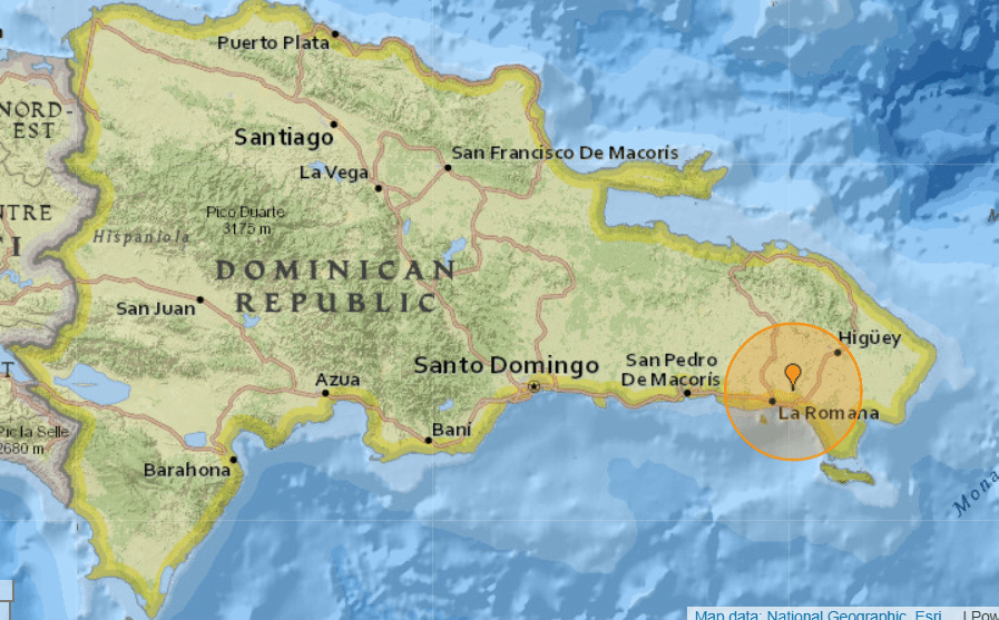
The U.S. Geological Survey (USGS) recorded a magnitude 3.9 earthquake approximately 9 kilometers east-northeast of La Romana at 11:55 a.m. Dominican Republic time on October 13. The event occurred at a depth of 117 kilometers, according to the agency’s earthquake monitoring data.
The earthquake was among several seismic events recorded around the Dominican Republic on Tuesday. The available monitoring records also show smaller tremors near Punta Cana, Miches and Sabana de la Mar, reflecting ongoing seismic activity across the island and surrounding waters.
Several smaller tremors recorded across the country
The National Seismology Center of the Autonomous University of Santo Domingo (UASD) documented several earthquakes in its catalog for October 13. These included a magnitude 3.0 event south of Punta Cana, a magnitude 3.2 earthquake northeast of Miches, and a magnitude 2.6 tremor northwest of Sabana de la Mar.
The USGS also listed a magnitude 3.4 earthquake approximately 54 kilometers north-northeast of Otra Banda, at a depth of about 22 kilometers. Differences between the agencies’ reported magnitudes and locations can occur because seismic monitoring networks use different instruments, data and analysis methods.
The UASD’s official earthquake catalog provides a searchable record of seismic events, including their reported magnitudes, depths, locations and times. The center is responsible for monitoring seismic activity and maintaining the Dominican Republic’s national seismic and accelerographic network.
Why the Dominican Republic experiences earthquakes
The Dominican Republic lies on Hispaniola, an island situated within the complex tectonic boundary between the Caribbean and North American plates. Their relative movement generates seismic activity across Hispaniola and the surrounding Caribbean region.
Two major fault systems, the Septentrional Fault in the north and the Enriquillo-Plantain Garden Fault system in the south, contribute to the island’s seismic hazard. The wider region also includes zones where the North American plate descends beneath the Caribbean plate, producing earthquakes at varying depths.
The USGS has documented the tectonic complexity of the region and the potential for damaging earthquakes. However, the occurrence of several small or moderate tremors on a single day does not, by itself, establish that a larger earthquake is imminent.
What residents and visitors should know
Earthquake magnitude and depth are important factors when assessing an event, but they do not alone determine whether people at the surface will feel shaking or experience damage. Local geological conditions, distance from the epicenter and building construction also influence the effects.
Residents and visitors should follow guidance from Dominican emergency management authorities and consult official seismic updates for confirmed information. Standard earthquake precautions include identifying safe places away from windows, securing heavy furniture and knowing how to protect oneself during shaking.
The monitoring records reviewed for Tuesday establish that several earthquakes occurred, including the magnitude 3.9 event near La Romana. The records cited here do not establish that the events caused damage, injuries or a tsunami.